Weekly Gem #173 The fault lies here!
Published 10/20/2018
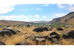
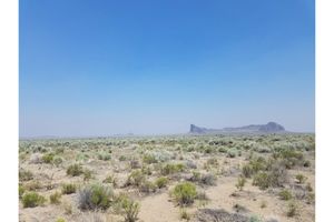
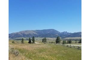
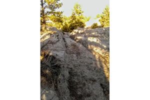
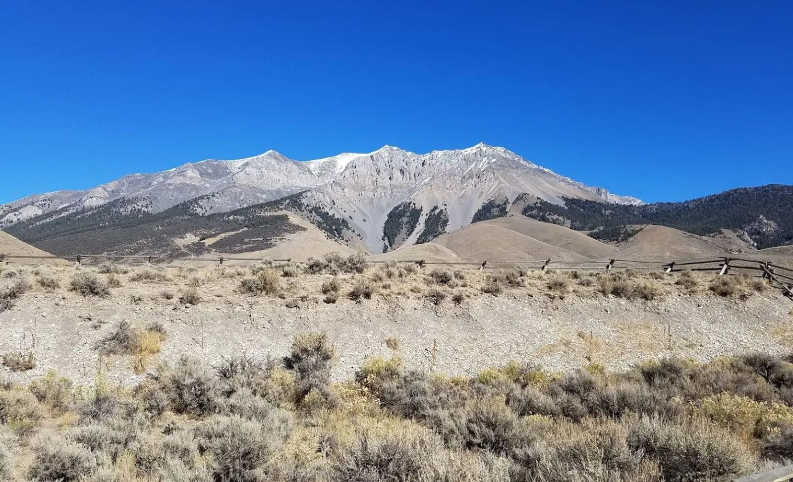
Location: This hidden gem is located about two miles up Doublespring Road, and about 25 NW of Mackay, ID (see the Clue Me! Map). You might think this is a photo of a particularly gorgeous mountain in the Lost River mountain range. While that part of the image is clearly a gem, allow your gaze to be drawn down. Further. To the area below the wooden fence.
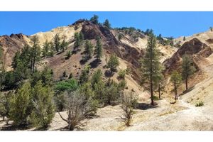
This Weekly Gem is a very clear and easy to reach example of the outcome of an earthquake. The earth's crust has a crack in it here, which is about 7 miles deep and 26 miles long (not coincidentally, this fault runs the full length of, and is right next to, the Lost River mountain range). The fault is tilted, so during an earthquake, the ground the photographer was standing on would move down, and backwards. The mountain would lift up. Up and away.
During the past few hundred years of geologic "stability," the crust under the west side of the valley was slowly sinking and diligently tugging westward. In October of 1983, a 7.3 magnitude earthquake snapped this portion of the valley into alignment. In a matter of seconds, the valley dropped by up to 9 feet, and the mountains behind rose by up to 1 foot. This scarp (i.e. the visible evidence of the quake) can be seen for miles on a line where the valley and the mountain range meet.
While we implied that this gem was not about the mountain, that wasn't entirely true. The scarp is a dramatic illustration of how much shifting can take place during an earthquake. The mountain is a dramatic illustration of how much shifting can take place from earthquake after earthquake after earthquake.
You see, at the top of this mountain, you'll find fossils of ocean life. The top of the mountain was once the bottom of an inland sea. It would have taken at least 600 earthquakes of the same magnitude as the one you see here to raise the sea floor to where it rests now. And of course, it's still going up.
.........
Here's the hidden gem entry from our Clue Me! map.
Clue
It's everyone's fault
Description
The scarp that is visible after the latest earthquake
Why It's Interesting
The amount of shifting during an earthquake is often not obvious, but this is one place where you can get the sense of what happens when the earth really moves. The valley where the photo was taken dropped about 7 or 8 feet. The mountain range you see rose by a foot. You can still see the result of that shift here.