Weekly Gem #139 Venice of the north
Published 11/4/2017
Location: This Weekly Gem is located at the east end of Norr Mälarstrand, in Stockholm, Sweden (see the Clue Me! Map). From the Stockholm city hall you have a great view of a juxtaposition you probably won't notice, and which we're therefore compelled to point out.
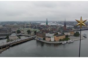
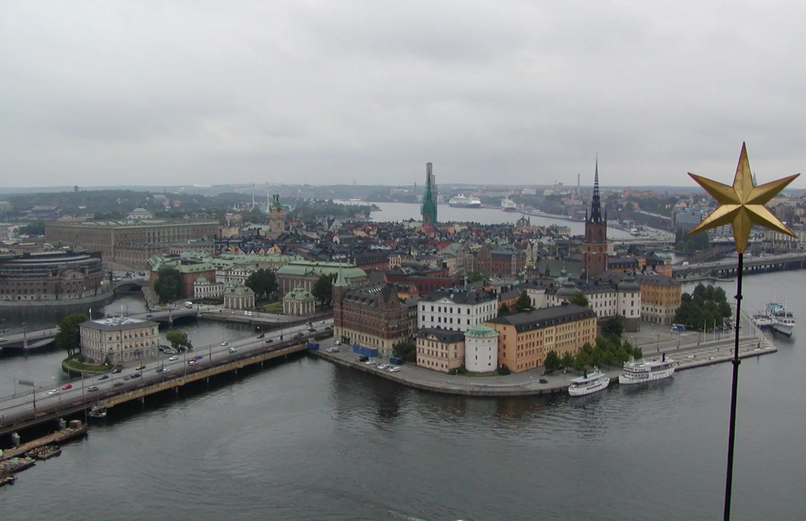
Of course there are things everyone will notice. For example, you'll see the 14 islands on which Stockholm was built ... smallish islands with lots of water that have resulted in the moniker of "Venice of the north." On one island (Gamla Stan, shown in the photo) is the fantastically well preserved old town.
What isn't obvious is that juxtaposition we mentioned.
Stockholm's 14 islands are essentially the first 14 of the Stockholm Archipelago. Head east by boat and you're in the Baltic Sea, but with 30,000 islands between you and open water.
Head west, north, or east by road, and you're on the mainland, next stop Oslo.
Head west by water and you're immediately in Lake Mälaren, an extremely large lake with an exceptionally intricate shoreline and 1200 islands of its own.
A little more about Lake Mälaren and Stockholm. Mälaren is currently 1 foot higher than the Baltic Sea, and at some times and tides, the Baltic still flows into Mälaren. But only a few hundred years ago, Lake Mälaren was Mälaren Bay ... an extension of the Baltic that pushed far into the heart of Sweden. Prior to about 1200 A.D. (when geologic rearrangement made the entrance to the bay exceedingly shallow), ocean-going vessels could sail all the way to the west end of Mälaren Bay.
Stockholm's original location was therefore not at the edge of the Baltic, but at the narrows leading into this bay. By being at the bay entrance, Stockholm could guard and deter unauthorized entry into the Bay. If an invading fleet wanted to move inland, it could enter the Archipelago through any of hundreds of routes, with no way to defend them all. But all of those routes gradually merged, with the crucial bottleneck at Gamla Stan (i.e. the original Stockholm). Any invading fleet would need to pass around Gamla Stan, through some of the narrowest channels in the Archipelago.
Once past Stockholm, invaders would find Mälaren Bay a haven of islands and inlets. Stockholm's position at the bottleneck and in the middle of the channel was therefore crucial to creating, building, and defending the nation of Sweden during the early years.
.........
Here's the hidden gem entry from our Clue Me! map.
Clue
A superb view
Description
The observation platform at the top of the city hall tower
Why It's Interesting
This is the best place to view Stockholm. It's centrally located, surrounded by the oldest parts of town. The tower itself is thrice as tall as any surrounding buildings on all sides, providing the perfect 360 degree view. From here you can see all fourteen islands on which Stockholm was built, including Gamla Stan, the island where the city began.